Copyright © Hiawatha Water Trail Association, all rights reserved

©
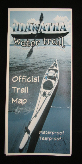
Hiawatha Water Trail Map
A water trail map for paddlers, designed by paddlers. Information on access points, campsites, trail hazards, water depth, navigation aids, public lands and much more all together on waterproof & tear proof paper.
Measuring 24 inches by 32 inches, there is one overview map at a scale of 1:204,000 as well as 8 map sections at a scale of 1:70,000. While the overview map allows the paddler to study the entire trail, the individual map sections enable a person to have the map under their deck bungies as they paddle along the trail.
Suggested retail price is $10 with proceeds supporting the Hiawatha Water Trail Association and its mission. Please check out our list of retailers below on where you can purchase your own map. Wholesale pricing for orders of 10 or more is available, please contact us for more information.
-
Down Wind Sports -
906-
-
Pictured Rocks/Hiawatha Natl. Forest Visitor Information Center -
906-